THE NEREZINE GARDEN PROJECT
Nerezine
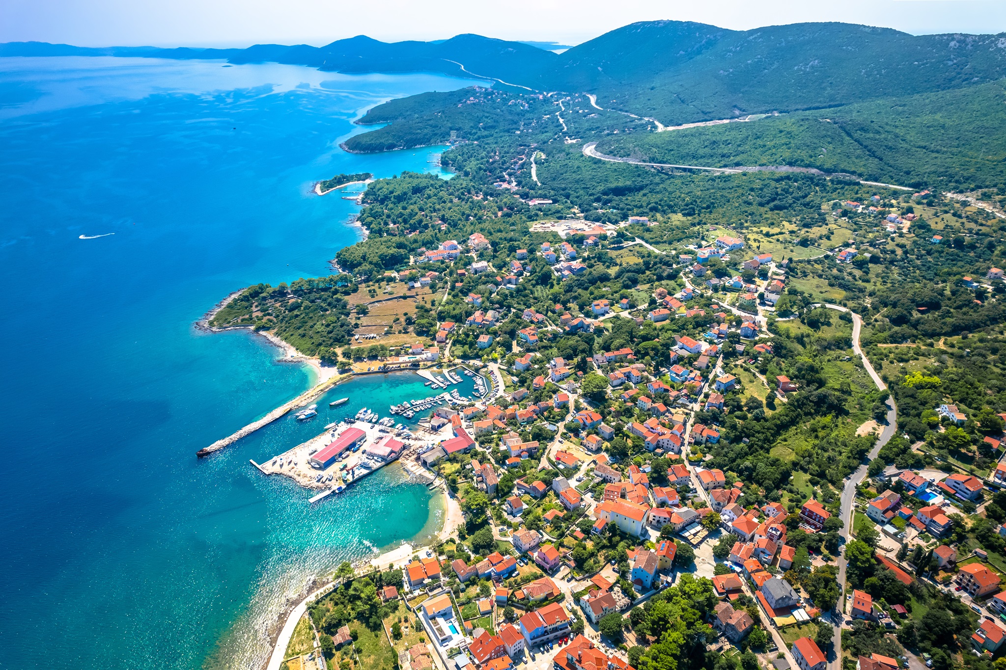
Nerezine is a historic coastal village on the eastern shore of the island of Lošinj, which belongs to the Kvarner island group in the Croatian Adriatic. The village lies at the foot of the Osoršćica mountain range, which rises in the northwest of the island and, with its highest peak Televrin at 588 meters, forms one of the most prominent elevations in the entire region.
Landscape and Sourroundings
Nerezine’s location at the transition between mountains and sea gives it a uniquely diverse landscape. The settlement itself gently stretches along the coastline and is surrounded by characteristic Mediterranean stone walls, olive groves, and macchia vegetation. The shift from the rocky, karst-dominated highlands to the coast is gradual: dry stone walls crisscross the slopes, where sheep once grazed. The upper areas are dominated by barren rocky terrain interspersed with low shrubbery, while the lower zones feature scattered cultivated plots and small gardens.
The coastline near Nerezine is shaped by coves, flat rocky sections, and small pebbled beaches. The sea here is especially clear, a quality enhanced by the low population density and the absence of major river mouths in the surrounding area.
Climat
Nerezine lies in a transitional zone between a sub-Mediterranean and a typical Mediterranean climate. Summers are dry and warm, with average temperatures ranging from 25 °C to 30 °C (77–86 °F) in July and August. Winters are mild, with average temperatures around 8–10 °C (46–50 °F), and frost is rare. Annual precipitation amounts to approximately 900–1100 mm (35–43 inches), with the highest rainfall occurring between October and December.
A characteristic climatic feature is the Bora, a cold downslope wind from the northeast that frequently blows during the winter months and can cause rapid drops in temperature. In contrast, summer is dominated by gentle sea breezes and the Maestral, a wind from the southwest that provides pleasant air circulation.
Flora and Vegetation
The plant life around Nerezine is typical of the evergreen sclerophyllous vegetation of the Mediterranean region. Due to the elevation differences between the coastline and the Osoršćica mountain ridge, distinct vegetation zones can be observed.
Coastal Vegetation:
Maquis shrubland featuring rosemary, myrtle, heather, rockrose, and kermes oak
Scattered pine groves, primarily Aleppo pines
Olive trees, often cultivated in traditional groves
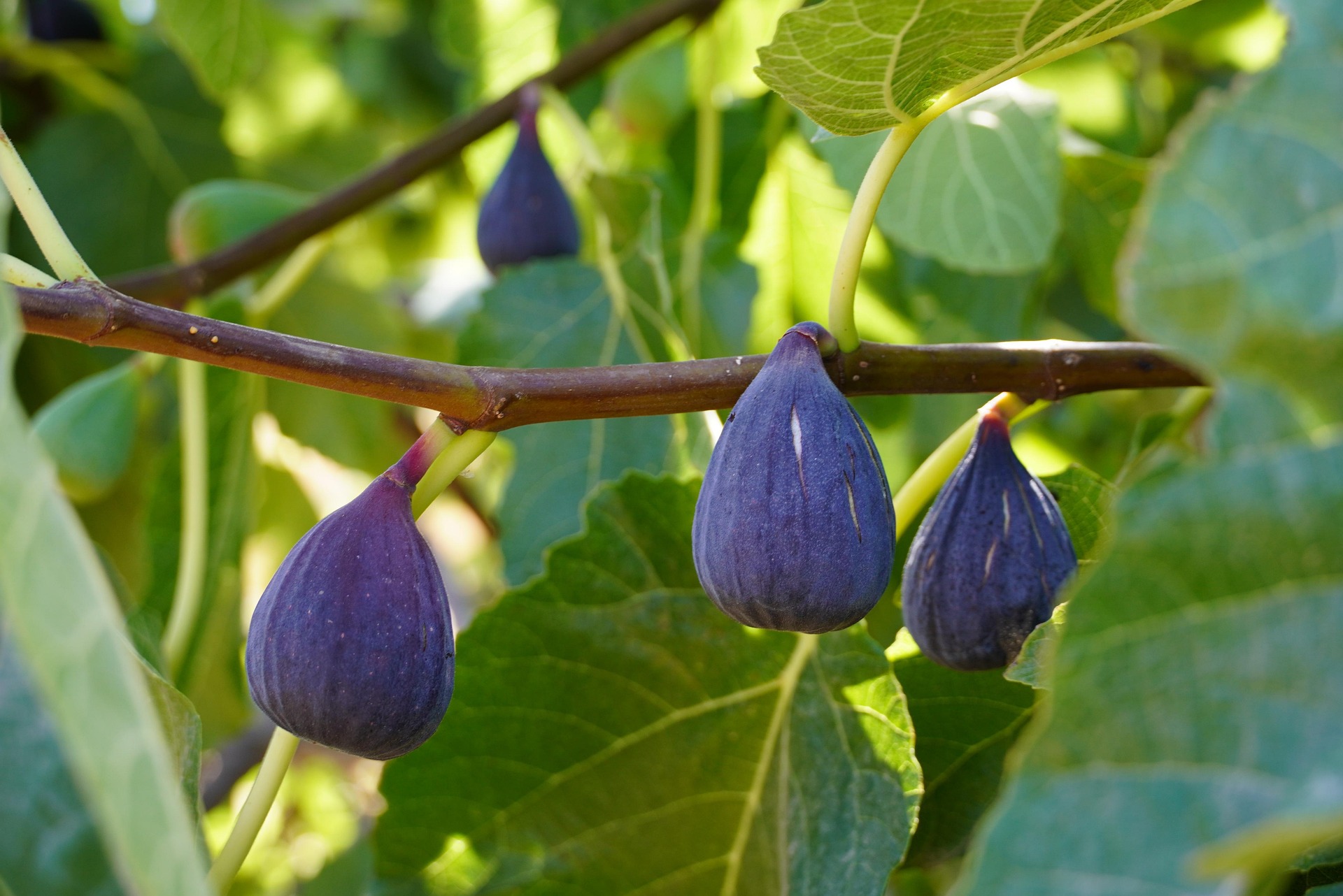
Wild-growing fig trees, cypresses, and bay laurels
Mid-Elevation Zones:
Denser maquis with holm oak (Quercus ilex), juniper species, and heather-like plants
Gradual transition to so-called garrigue – an open, herb-rich vegetation type
Abundant aromatic herbs such as sage, thyme, and lavender, especially on rocky south-facing slopes
Summit Region (Osoršćica):
Dominance of low-growing, hardy species
Endemic plants such as Campanula istriaca (a bellflower)
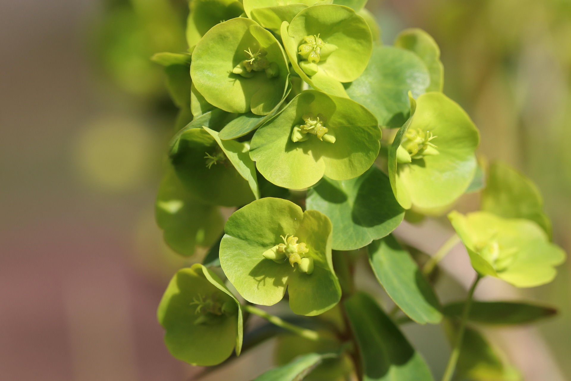
Karst-adapted species like rock yarrow and various spurges
The Osoršćica mountain is a significant destination for botanically interested visitors, offering the chance to observe many rare and endemic species – some of which are relics from the Ice Age that have survived on isolated karst plateaus.
Geological Features
The island of Lošinj, home to Nerezine, belongs to the Dinaric karst system, which stretches along the eastern Adriatic coast and is characterized by highly karstified limestone landscapes. The geological formations around Nerezine, and especially the Osoršćica mountain, vividly reflect these processes.
Rock Types and Structures
The dominant rock in the region is limestone, mostly dating from the Cretaceous period (approximately 145–66 million years ago). These are thick layers of marine sediments that were deposited in a shallow, subtropical ancient sea. During the Alpine orogeny, these rocks were folded, uplifted, and in places fractured. Lošinj lies along a major tectonic fault line – the so-called Osor Fault – which separates the islands of Lošinj and Cres. This fault passes near Nerezine and has been geologically active in the past.
The Osoršćica itself is an uplifted fold structure whose layers dip steeply to the northeast. Due to uplift and erosion, older rocks are now exposed at the surface – a striking feature of this zone.
Karst Features
The area around Nerezine is marked by pronounced karst phenomena:
Dolines – funnel-shaped depressions formed by the dissolution of limestone
Limestone pavement (karrenfields) – small-scale, furrowed rock surfaces created by chemical weathering
Sinkholes (ponors) – natural drainage funnels where rainwater disappears into underground cavities
Caves and crevices – including small grottos in the Osoršćica or along the coast, many of which remain only partially explored
The karstified surface also means that surface water is virtually absent. Rainwater quickly seeps into the porous rock, forming underground watercourses and cave systems – key features of a karst hydrological system.
Coastal Features and Tectonic Activity
The coastline near Nerezine exhibits both geologically young sediment deposits (such as fine gravel beaches) and tectonically influenced cliffs. In some areas, visible rockfalls point to recent tectonic uplift or marine erosion. The proximity to the Osor Fault also explains why minor, localized seismic events have occurred in the past – further evidence of the region’s geodynamic activity.